On The Flame Chub Survey, We Truly Hit The Back Roads
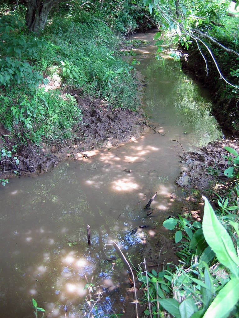
Eudy Cave spring run, tributary to Little Cotaco Creek, Marshall County, Alabama:
 We went out yesterday headed due south from Huntsville down Highway 231 to visit some of the relatively few historic flame chub sites on the south side of the Tennessee River. It hasn't rained for a week, and the day turned out to be very sunny and hot.
Our first site was Eudy Cave in Marshall County, about 15 km northwest of the town of Arab (no lie...). Our Mapquest maps turned out to be reasonably accurate; but once there we couldn't quite figure out how to get to the site. After some circling around and scouting a farm property with cow pastures along a creek at the base of two ridges (this involved Daniel being chased by a llama and two goats, luckily he ran fast and back over the fence) we stopped and asked at the house that seemed to be the farmer's. Mr. Saylor was used to people asking to visit the cave on his property, so he allowed us to drive into his pastures as long as we secured the gate behind us. He said cross the creek, hop the barbed wire, and a trail would take us to an obvious site.
Well, not so obvious. As we hiked out after parking the truck along the creek, we couldn't figure out where exactly the cave was; there was only so much barbed wire we were willing to slither over and under. But, we did find an obvious spring run creek at the base of one ridge, so as the cows bellowed at us we sampled this creek. Voila, we found a flame chub in the third setting, along with a banded sculpin, black darter, striped shiners and bluntnose minnows. So we wrapped up and hit the road, as the cows angrily glared at us. Comparing the GPS coordinates I took to the ones in the museum records, we must have been only 100-200 meters from the cave opening and pool. Puzzling, but I'm convinced flame chubs are still in the stream system.
Our next stop was the intersection of Highway 278 and Big Spring Creek east of Brooksville in Blount County. This site is right at the base of part of the Tennessee Valley Divide, forming the southernmost pocket of the Tennessee drainage. We didn't even see the creek until a second pass, it was so overgrown by privet and native vines. Highway 278 is now a major highway compared to the original site visit in 1975, and there was no way we could stop on the highway. We pulled into a really spooky abandoned cement factory (?) abutting the creek and tried to bushwack through the creek bottom jungle to find the creek. Finally we did, and found a mess; the creek now has steep banks, with deep, opaque, slowly moving water choked with large woody debris. No way could we seine it, not without casualties anyway. The museum record describes the site as surrounded by pastures and woodland; now it's the rural equivalent of a vacant lot. My guess is that flame chubs are no longer in this location, although that's only an educated guess.
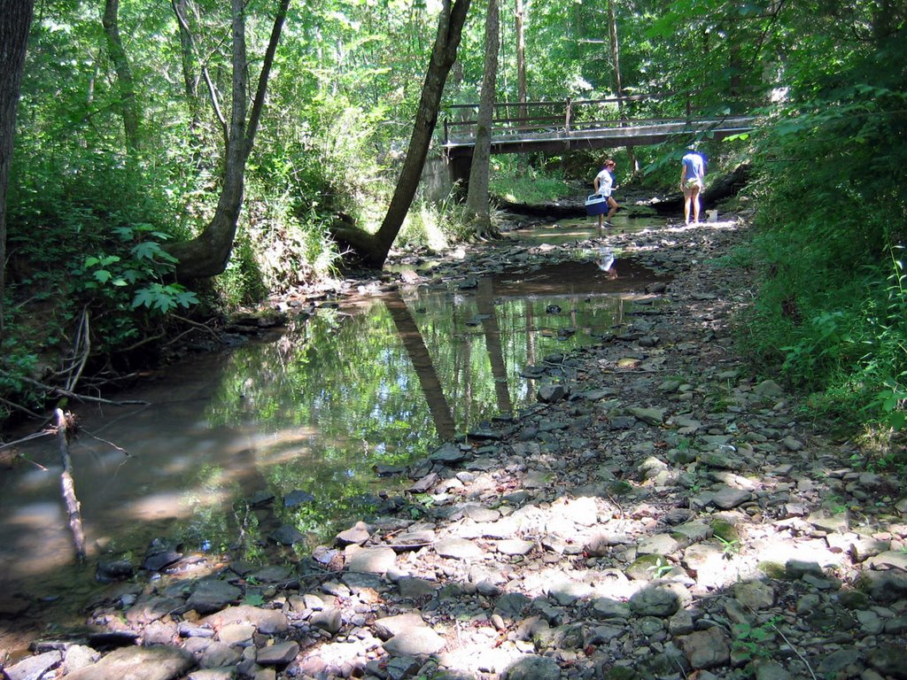
Finally, we entered the Heart of Darkness and drove up Highway 67 into the southeastern corner of Morgan County, in the middle of the most rugged parts of Brindley Mountain. We were trying to find a site allegedly accessed by a "jeep trail" on the West Fork of Cotaco Creek back in 1993, described as being "2.25 miles NNE of Center Dale". I figured that this might be along a spur called Blocker Road, off of Rock Creek Road. On our first pass, we got hopelessly lost as the road names and layout had little to do with what was represented in both Mapquest and Delorme maps. Finally we found Blocker Road, a gravel road, and drove to the end of it looking for creek access. We didn't find it; we deadended at one house with 4 giant dogs out in front of a sign saying, "FIRING RANGE Do Not Enter", and deadended on another fork of the road in front of a dilapidated trailer while an even larger dog ran around the truck and a giant bearded guy came out and glared at us as we turned around and left. OK, see ya later! We finally found access to Frost Creek, about 600 meters upstream of the apparent historic site where several creeks join to form the West Fork, along another gravel road called Childers Road. Was this the real site, since Childers Road isn't much of a road? We found that the creek there was cold, clear and spring-fed over cobble and gravel, deeper at the downstream end of our visit; I think we found 6 springs running into the creek over the ~300 meters that we sampled. The only fish we found were green sunfish, blacknose dace and creek chubs. Since we were within 400 meters of the reported site at our closest sampling activity, I'm going to count this as an historic site visit, with negative results for flame chubs.
Below, looking downstream on Frost Creek at the Childers Road bridge, near Center Dale, Morgan County, Alabama.
posted by Bruce Stallsmith @ 2:43 PM
0 comments
![]()

0 Comments:
Post a Comment
<< Home