Dauphin Island Trip
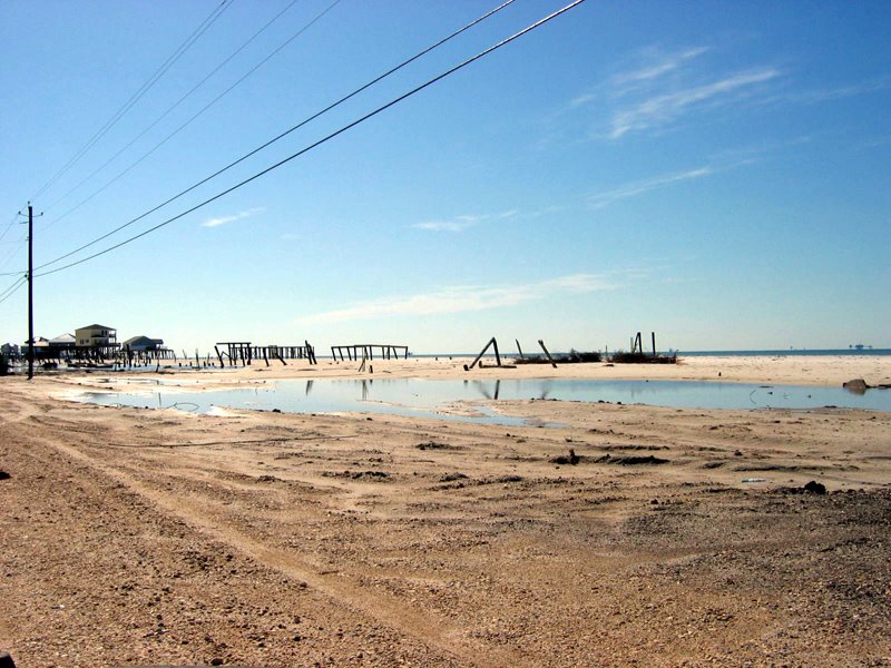 I know that everyone has seen too many images of damage from Hurricane Katrina. But I had to share the above photo I took yesterday on the western end of Dauphin Island, AL, at the mouth of Mobile Bay. Dauphin Island is the easternmost edge of really severe damage from Katrina, in particular the above area that used to be packed with expensive beachfront homes. Now the main road barely exists; you can see what's left of it in the lower left of the photo, just packed sand. In this field of view you see two ruins in the midrange. There were probably 20 houses in this view before the hurricane came in from the Gulf, on the right of the picture. Most of the debris has been cleared, so what's left is just barely an island anymore at this point, maybe closer to a low-tide bar. The most insane thing is that many property owners are rebuilding along this strip, which is a typically exposed barrier island. Human goofiness knows few limits.
Luckily the Sea Lab itself survived with minor damage at the eastern tip of the island. The research facilities are being expanded as I write. A new Marine Science research center will be finished by October, with seven new labs of different types. One of the labs is explicitly designed for visiting researchers so they can sort and pack collected specimens or physical samples. Another new building is also being planned, a new lab building across the street from the Marine Science center that will be built and partially staffed by the National Marine Fisheries Service. The Sea Lab hopes that this will allow collaboration between NMFS scientists who are mostly fisheries biologists, and the Sea Lab faculty who are community ecology oriented. This new lab building would also allow expanded collaboration both with graduate students and visiting researchers. So things look good for the Sea Lab I'm happy to say.
posted by Bruce Stallsmith @ 5:29 PM
0 comments
![]()

0 Comments:
Post a Comment
<< Home